


For all users…
Are you interested in a poster of your region or neighbourhood, your city or your village?
Do you wish to use an aerial photograph for juridical purposes, in order to indicate the state of your property's surroundings some years ago?
In GEOMATICS' rich archives you will probably find what you search for and have it at your disposal next business day, either in digital form or high quality prints, in sizes varying from 23cm X 23cm to giant poster size. Moreover, our engineers will help you with the image's photo interpretation using stereo photo and survey orientated techniques.
For professionals and engineers…
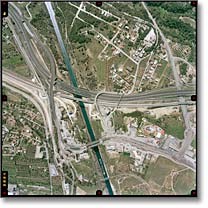
Are you a professional interested in a high resolution and detailed image of the area surrounding your tourist or industrial facilities? Are you involved into real estate business and looking for high accuracy images of your area of interest?
Contact us, and you will surely find what you are looking for. Even if we don't currently possess recent aerial photographs we can plan your area's coverage in one of the many aerial photography missions that we constantly realise.
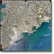
Are you an engineer or consultant interested in aerial photographs in either print or digital form for the compilation of photogrammetric diagrams and digital orthophoto maps at various scales?
We can immediately provide you with digital images, contact prints, diapositives or scanned images of various resolutions as well as all the necessary data (camera calibration reports) for immediate use in analytical stereo-plotters or digital photogrammetric workstations.
Are you interested in topographic basemaps of an area for your survey purposes?
We are able to produce topographic basemaps of your area of interest in vector or raster format, rapidly, at low prices, utilizing up-to-date technologies based on the use of aerial photography and photogrammetric techniques.
Obtain high resolution and accuracy topographic basemaps which offer rich geospatial information enabling you to carry out an efficient, effective and correct survey.
If you already know how to use the application and wish to search for aerial photographs or digital orthophoto maps of a certain area of interest, click here.
In order to read the use instructions of this search application, click here.